Last week, our founder Michael Kalam presented UK Planning Gateway at Ordnance Survey headquarters. The room was full of people who work with the foundations planning relies on: mapping, land and property data, and the infrastructure that makes location-based decisions possible at scale.
It mattered because there was a shared sense that planning improvement is increasingly about structure and workflow, not only policy. If the inputs into the system are inconsistent, unclear, or hard to validate, the system absorbs the cost later, and usually at the worst possible moment.
Why the submission stage now shapes outcomes
Every year, hundreds of thousands of planning applications are submitted across England. In a high-volume system, the submission stage cannot just be treated as admin before “real” planning begins.
Local validation has become more specific. Evidence standards are higher. Pressure on local authority capacity is real. All of that means the quality and structure of an application at the point of submission can influence what happens next.
When a pack is incomplete, inconsistently labelled, or unclear on basic points like boundary definition, friction starts immediately. It becomes extra email threads, resubmissions, revised drawings, missed windows, and delays before an officer can even begin assessing the proposal. The “front door” of planning has become strategically significant because it sets the evidential baseline for everything that follows.
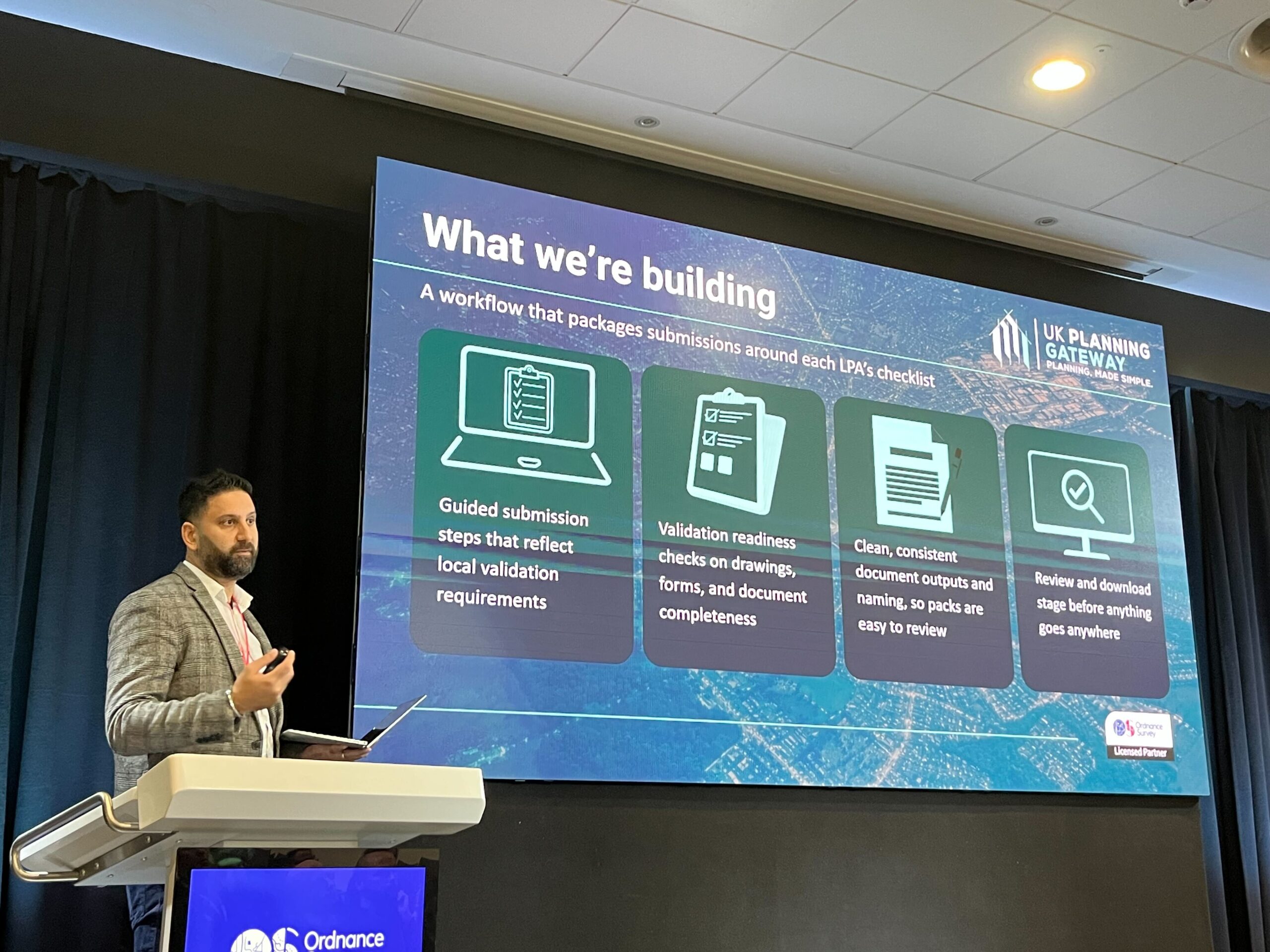
What we are building
UK Planning Gateway is intentionally focused on this narrow, structural point in the process: how applications are prepared, checked and packaged before they enter determination.
We are not trying to replace statutory gateways. We are not changing planning policy. We are strengthening how submissions are assembled against each Local Planning Authority’s validation checklist so that avoidable invalidation and preventable rework are reduced at source.
In practical terms, we are building a workflow that:
- Guides users through steps that reflect local validation requirements
- Runs validation-readiness checks across drawings, forms and document completeness
- Produces clean, consistent document outputs and naming, so packs are easier to review
- Gives a structured review stage before anything is formally lodged
This is not about adding complexity. It is about removing the repeated failure points that consume time for applicants, agents, and validation teams.
Why geospatial infrastructure is part of the answer
Presenting at Ordnance Survey HQ also reinforced a simple point: the UK has authoritative spatial datasets. The challenge is using that data in day-to-day planning work in a way that improves submissions, not just maps.
For validation, mapping is not a background detail. It sits underneath basic checks: whether the site boundary is clear, whether plans are properly referenced, whether constraints and designations should be surfaced early, and whether the submission is coherent as a set.
Geospatial infrastructure provides the foundation. Structured submission logic provides the operational layer. Without both, the system ends up with ambiguity, avoidable errors, and unpredictable outcomes.
Planning, growth, and professional responsibility
Planning is routinely discussed as central to growth. If that ambition is serious, reform needs to include workflow reform, not only policy reform.
Better submission quality benefits everyone: architects and planning consultants spend less time on packaging and rework, local authority validation teams spend fewer cycles on preventable issues, planning officers receive clearer evidence at the start, and applicants experience fewer avoidable delays.
Reducing friction is not only about speed. It is about predictability and system integrity.
A measured approach
UK Planning Gateway has been shaped by delivery experience and real submission friction, not abstract critique. The objective is not disruption for its own sake. The objective is structured improvement at a high-volume point in the process that affects everything downstream.
If you want to understand how UK Planning Gateway structures submissions around local validation requirements, you can explore the platform here